Google’s AI Image Tool Sparks Deepfake Concerns Among Experts
In a move that has raised eyebrows among open-source investigators and journalists, Google has introduced a new AI-driven feature on its Google Earth platform, enabling users to generate satellite images with ease. This innovation, announced on Thursday, promises to enhance creativity but simultaneously poses risks for misinformation.
Described as a tool to collaborate with users’ imaginations, the feature allows individuals to simply zoom in on Google Earth and type what they wish to visualize. As Bryan Horowitz, a Google product manager, articulated, “Just zoom in to a place in Google Earth on web, tap ‘create image,’ and type whatever you want to see.” For those relying on satellite imagery to validate news and incidents in less accessible regions, the implications of fabricating satellite imagery with minimal effort are alarming.
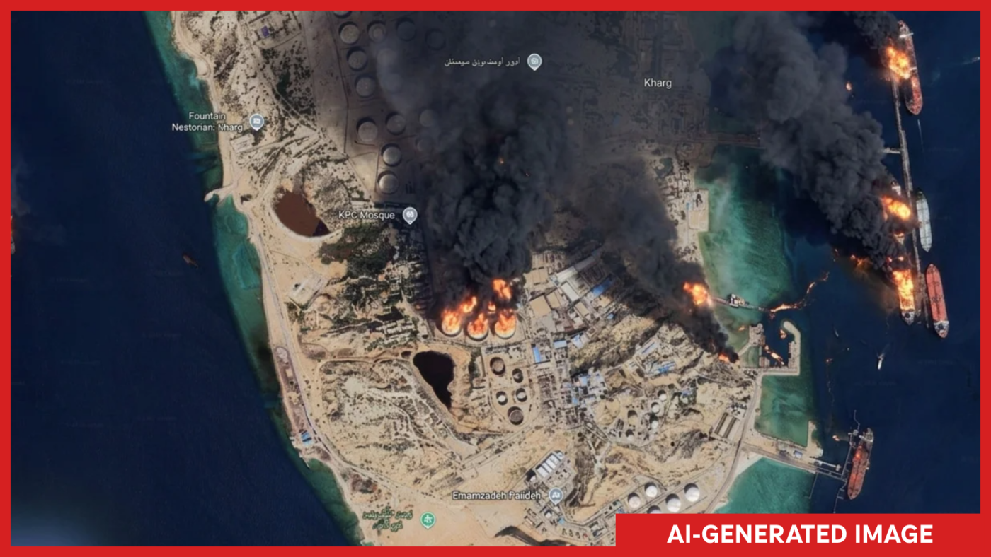
NPR successfully demonstrated the tool’s potential by creating fictitious scenarios like Iran’s Kharg Island engulfed in flames and flooding at the U.S. Capitol. Such fabricated events, if real, would undoubtedly capture global attention.
Open-source researcher Henk van Ess tested the tool’s boundaries, generating images of non-existent events such as refugees at the Mexican border and a bomb crater in Gaza, all of which were accepted by the tool. He expressed his concerns in a conversation with NPR, highlighting the tool’s potential for misuse.
Echoing these worries, visual forensics investigator Evan Hill from the Washington Post questioned Google’s internal testing processes, stating on X, “Very curious how or if this idea was red teamed internally because the opportunities for abuse and disinfo are literally boundless.”
Satellite Imagery Under Scrutiny
Traditionally, satellite imagery has served as a reliable method for verifying events, given its difficulty to replicate. As Jake Godin from Bellingcat explains, “Satellite imagery has been kind of a safe bet when it comes to verifying an event because it’s hard to fake.” However, this new tool challenges this assumption by potentially making it easier to create deceptive images.
Emerging Threats of Fake Satellite Images
Instances of fake satellite imagery have already surfaced, such as during the early U.S.-Israel conflict with Iran when fabricated images of a damaged U.S. base circulated in Iranian media. These images reportedly utilized Google Earth and AI to depict non-existent damage, leading to confusion until real satellite images confirmed otherwise.
Godin warns that the ability to produce AI-generated satellite images rapidly could exacerbate the spread of misinformation. As he notes, “Misinformation travels further and faster than any sort of correction,” potentially leading to increased skepticism even towards genuine satellite images.
Google has yet to respond directly to these concerns but has emphasized its commitment to countering misinformation. In a statement on X, the company highlighted the use of its SynthID watermark to label AI-generated images, aiming to prevent misuse.
Despite these assurances, apprehension remains high within the open-source community, which has relied heavily on Google Earth for verifying social media content. As van Ess remarked, the irony now is that “The fake is made inside the thing people use to check whether pictures are true.”
This article was originally written by www.npr.org